File:Hökaland continent.png
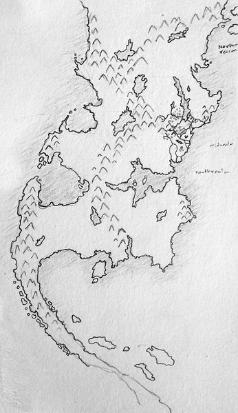
Revision as of 12:52, 7 September 2014 by Leord (talk | contribs) (The map covers the main continent of the world of Hökaland and includes the realms of Northrealm, Midrealm, Southrealm, the Elven lands as well as the dragonlands among other areas. Category:Maps)

Size of this preview: 346 × 599 pixels. Other resolution: 578 × 1,000 pixels.
Original file (578 × 1,000 pixels, file size: 551 KB, MIME type: image/png)
The map covers the main continent of the world of Hökaland and includes the realms of Northrealm, Midrealm, Southrealm, the Elven lands as well as the dragonlands among other areas.
File history
Click on a date/time to view the file as it appeared at that time.
| Date/Time | Thumbnail | Dimensions | User | Comment | |
|---|---|---|---|---|---|
| current | 12:52, 7 September 2014 |  | 578 × 1,000 (551 KB) | Leord (talk | contribs) | The map covers the main continent of the world of Hökaland and includes the realms of Northrealm, Midrealm, Southrealm, the Elven lands as well as the dragonlands among other areas. Category:Maps |
You cannot overwrite this file.