Difference between revisions of "File:Hökaland maps in perspective.png"
Jump to navigation
Jump to search
(This picture shows the Hökaland main continent in relation to the more detailed maps, kingdoms and down to a map of Capitoleum. Category:Maps) |
|||
| (One intermediate revision by the same user not shown) | |||
| Line 5: | Line 5: | ||
[[Category:Maps]] | [[Category:Maps]] | ||
[[Category:Images]] | |||
Latest revision as of 14:38, 9 February 2015
This picture shows the Hökaland main continent in relation to the more detailed maps, kingdoms and down to a map of Capitoleum.
File history
Click on a date/time to view the file as it appeared at that time.
| Date/Time | Thumbnail | Dimensions | User | Comment | |
|---|---|---|---|---|---|
| current | 12:59, 7 September 2014 | 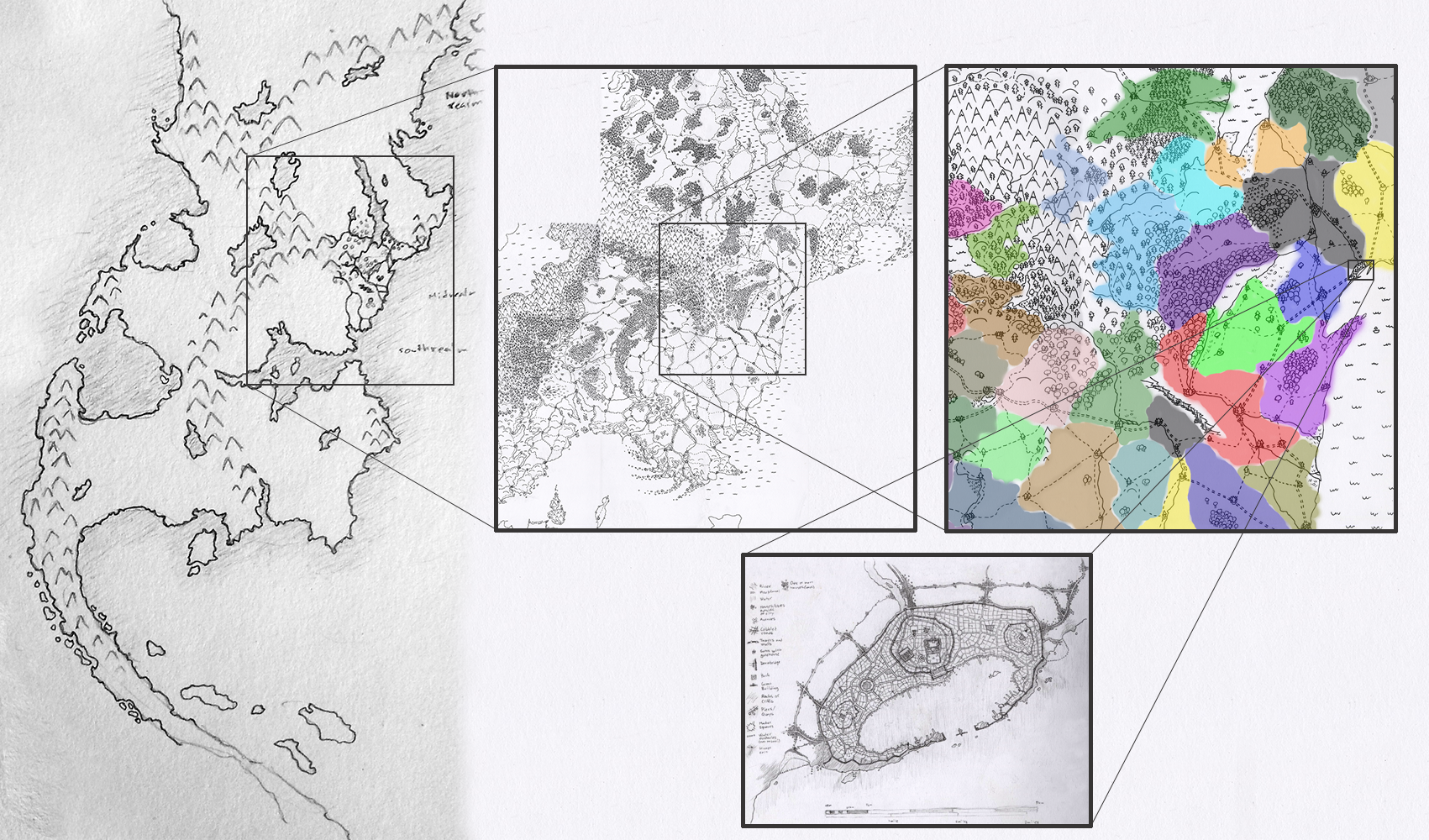 | 1,701 × 1,000 (2.18 MB) | Leord (talk | contribs) | This picture shows the Hökaland main continent in relation to the more detailed maps, kingdoms and down to a map of Capitoleum. Category:Maps |
You cannot overwrite this file.
File usage
The following 4 pages use this file: